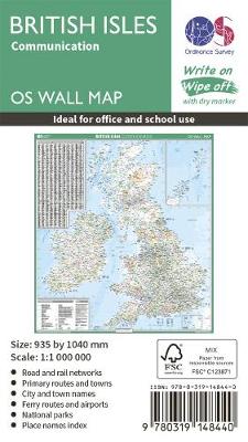
British isles communication
Éditeur :
Ordnance Survey
ISBN :
9780319148440
Date de publication :
8 mai 2019
Langue :
Anglais
Pays d'origine :
Grande Bretagne
This map shows the British isles, with all the major road, rail and sea connections. It is supplied rolled in a tube and is ideal for schools, students or just for decoration. It includes an index of place names. This map is gloss coated, so can be written on with suitable dry-wipe pens. It's scale is 1: 1 000 000