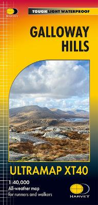
Galloway hills ultramap: xt40
Éditeur :
Harvey Map Services Ltd
ISBN :
9781851377282
Date de publication :
24 juil. 2025
Dimensions :
15,2 x 7,3 cm
Langue :
Anglais
Pays d'origine :
Grande Bretagne
The Galloway Hills form part of the Southern Uplands of Scotland. This map for hillwalkers covers Glen Trool and Loch Dee north to Loch Doon and Carrick Forest. It covers a large part of the popular Galloway Forest Park. 1:40,000 scale.