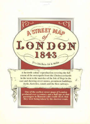
Street map of london, 1843, a
Auteur :
Davies, B. R.
Éditeur :
Davies, B. R.
ISBN :
9781873590003
Date de publication :
1 janv. 1991
Dimensions :
38,0 x 65,0 x 0,2 cm
Poids :
59 g
Langue :
Anglais
Pays d'origine :
Grande Bretagne
An early street map of London published a century and a half ago so that passengers in Hansom cabs could check that they were being taken by the shortest route. It shows street names, prominent buildings, docks, factories, canals and the earliest railways in minute detail.